WHAT WEST BROMWICH LOOKS LIKE NOW
Fire station in Hargate Lane (Thanks to Anne Wilkins for the photo, this was where her Grandmother's house and Garden once stood !)
Hargate Lane Church Now The Gap Centre (Many thanks to Anne Wilkins for the Photo) 

Hargate Lane (now blocked) just by the sandwell Road Labour Club (All of this is soon to be demolished to make way for Tesco's, BT and a leisure complex so this photo will soon be moved into 'WEST BROMWICH NOW GONE' Page )
The Expressway cut right through Hargate Lane, leaving this end of Hargate Lane cut off and only accessible via Sandwell Rd
Car park in Hargate Lane
Hargate Arms Public House sign (Used to be the China Clipper), Hargate Lane and All Saints Way junction 
Queens Head Public House, church Lane (Thanks to Judith Saddler for the photo) 
Hall End Tavern (Rampa Tampa) Vicarage Road 8/4/09
114 Vicarage Road, built around 1934 to replace an older property opposite, occupied by the Horton family between 1898 and 1918. The new pub was originaly owned by William Butler & Co before passing to Mitchells & Butlers, Bass and then Punch Taverns. The plastered wall underneath the For Sale sign used to serve as an off licence where you could get a bottle filled for your Dad's beer and buy crisps & scratchings and the gully on the right hand side of the pub is a gully which we used to go down towards Hatley Heath to go to school and I am sure there used to be a big farmhouse owned by the ceany (sp) family on the right hand side of this photo, down the gully ??
Looking down Vicarage Road towards Bank Street, at the junction of Stanway Road 8/4/09
Vicarage Road looking towards Hall End Methodist church.
The building with the square addition, by the lampost used to be a sweet shop run by 2 old sisters but closed down after getting many robberies and Dave's the barbers is just past it
Looking up Vicarage Road towards Heath Lane 8/4/09
On the very right corner of this photo once stood a fish & chip shop which stood on the corner of Stanway Road and Vicarage Road and a few doors up used to be a womens hairdressers, then up from there on the corner of Ebrington Road there is a newsagents which used to be run by Greens, then Burtons and now the present owners and over the Ebrington Road we had V.A. & R.G. (Vera & Robert) Westwood, the Butchers which was there for years and is now a hairdressers. You can just see the Rampas Pub Sign opposite the Newsagents
St Philips Church, Beeches Road 1/3/09
Herbert Street from Park Gates, Madeline Carroll the famous actress was born at number 32 (Now 44)
Bluebells sculpture by Tim Tolkien at Sots Hole, Dagger lane

"Kissing Gate", Entrance to Sots Hole
A set of Photos taken & Donated by Anne which were taken on the 18th February 2008, the day the Mercian (Staffordshire Regiment) marched in West Bromwich, 60 years since they were awarded the freedom of the Town
Marching up the High St from Carters Green (taken from outside the Old Main Post Office)
Old Soldiers waiting for the March past, Lodge Rd / High St
The Regiments Ram Mascot leading the way
Heading towards the Library, past the Town Hall 
Band going past the Mayor outside the Town Hall 
Regiment with fixed Bayonets going past the Town Hall
Ram Mascot leading the way down Lodge Rd from Edward St on the way back to the T.A Centre at Carters Green
Where the Gala Baths once stood, looking towards Edward Street Hospital, where the Old District Hospital stood (Many thanks to Anne for the Photos)


Looking up a Snowy Garratt Street with the Jesson fields on the top right 5/2/09 © Copyright of Paul Swift
Looking up Clive Street from Garratt Street 5/2/09 © Copyright of Paul Swift
Half way up Clive Street looking towards Shaftesbury Street 5/2/09
© Copyright of Paul Swift
The Vine Public House Roebuck Street 30/12/08 (Thanks to Anne for the photos)


Salter Works from Overend St 23/10/08


Dart Spring, Overend Street showing Water Street 23/10/08

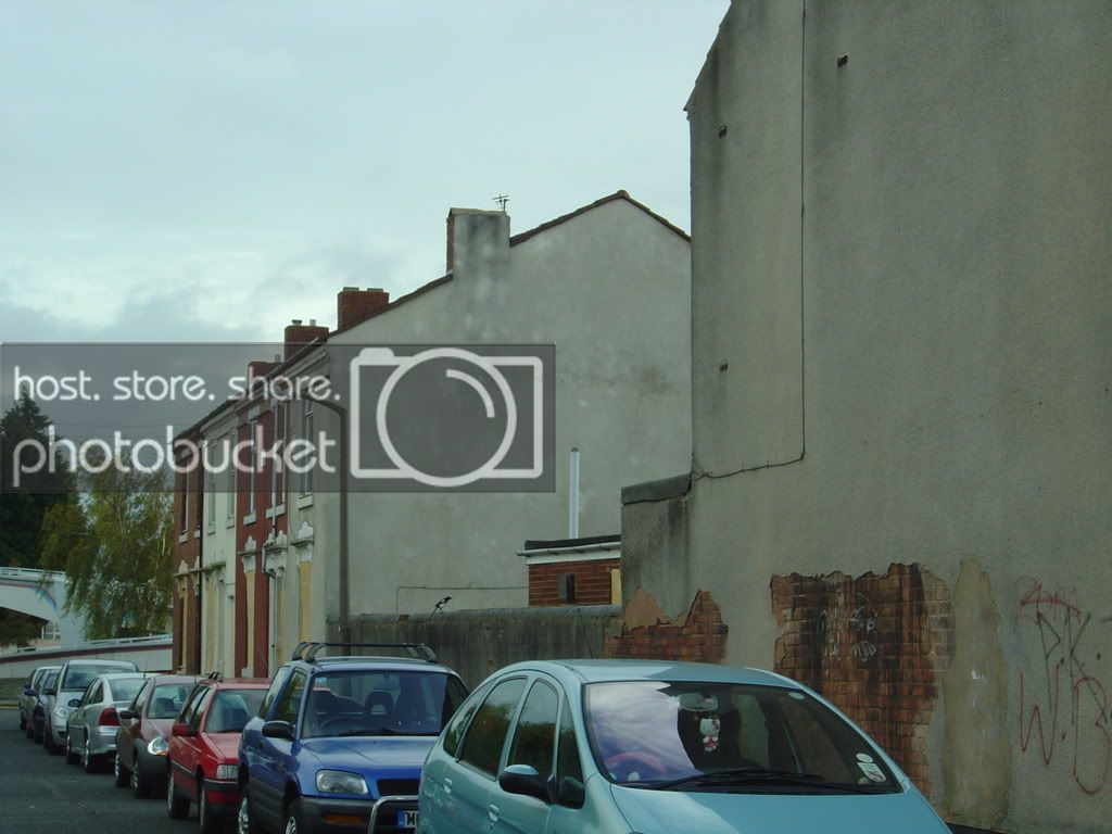
Looking up Water Street towards Overend Street from High Street


Dartmouth Square now 23/10/08
Old and new. The controversial pUBLIC Arts building with St Michaels Church in the distance, taken from where the B&Q Carpark was 23/10/08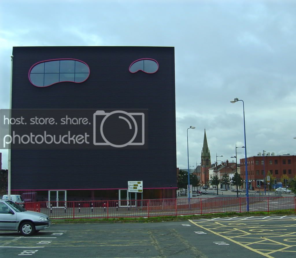
Alfred Street close to Demolition

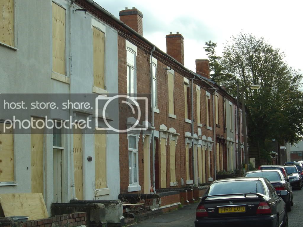
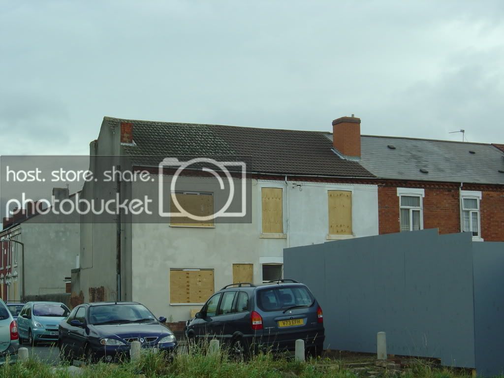
Taken on 23/10/08

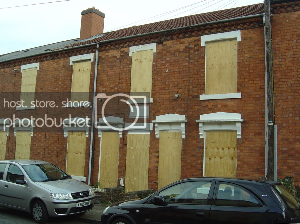
Alfred Street, just off New Street with many houses boarded up ready for demolition for the new Tesco Development in the name of 'progress' 17/10/2008

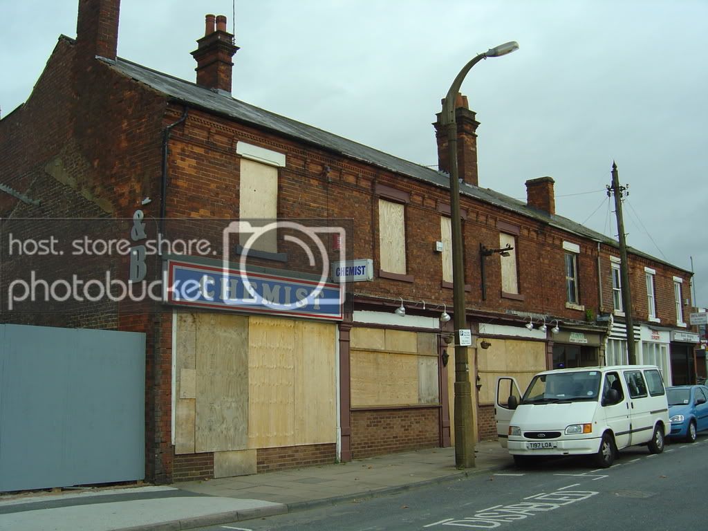
New Street shops which will also go in the name of 'progress' 17/10/2008

Looking down the High Street with the Anchor pub all boarded up on the left, K&J Clock clearly seen farther on and St Michael's Church Spire in the distance 17/10/2008

Looking towards Carters Green from outside the Anchor Pub, Town Hall Spire, Library and the Old Gas Building on the left. The Gas building replaced a building after the war as the previous building took a direct hit in the Bombings 17/10/2008
Highfields House, High Street 2002


Oak House 2002


The Oak House was donated to the people of West Bromwich by Alderman Reuben Farley, who had been elected mayor five times by the people of West Bromwich. Robert Farley was a philanthropist and the house became home to a large Victorian collection of moths, butterflies and stuffed animals. Nowadays it is used for visitors to experience the Tudor way of life and take pleasure in this fine example that dates back to circa 1600. Early records show that it was originally the home of the Turton family before being acquired by Alderman Reuben Farley in 1898. The house contains a fine selection of oak furniture and features items on loan from the Victoria and Albert Museum. (Thanks to Anne for the Photo)
Heath Lane Cemetery Gates 2008

Heath Lane Cemetery Gates 8/10/2008 (Taken from roughly the same spot as the Heath Lane Photos on the Home Page)
Heath Lane Cemetery Pauper memorial 2008
From January 1874, for the first time, the terms ‘Common’ and ‘Public’ are both used to describe a class of grave. It would appear that the term ‘Common’ applied to any purchased grave which was not a brick grave, whilst ‘Public’ referred to graves which were not the exclusive rights of burial were not purchased. This is supported by the fact that the burials as being from the ‘Union’ where buried in ‘Public’ rather than common graves.
Burials at the public expense are not allowed by law to erect a headstone or marker hence we cannot see where an individual has been buried
This monument is dedicated to those Paupers who are 'lost' in Heath Lane

Picture taken just inside the Walsall Road entrance on 8/10/2008
All Saints Church (Old Church) 2008

Taken from just before the junction between Arlington Road and All Saints Way (See old Postcard on Home page which it taken from the same place). The Old church is behind the trees on the top right. Taken 8/10/2008

Taken from the busy All Saints Way, looking towards the Newton Road (taken from about the same place as the 1904 Postcard on the Home Page) 8/10/2008
Ring Of Bells Pound Wall 2008


All that is left of The Ring Of bells Public House. This wall is situated on the left hand side of All Saints Way going towards West Bromwich, Just passed The Old Church and this Pound was used to keep the horses in and once held the stocks
The second Photo was taken around about the same place as the 1913 Postcard on the Home Page
Churchfields School green fence (school now gone) can be seen in the background 8/10/2008